


Yield Roadway
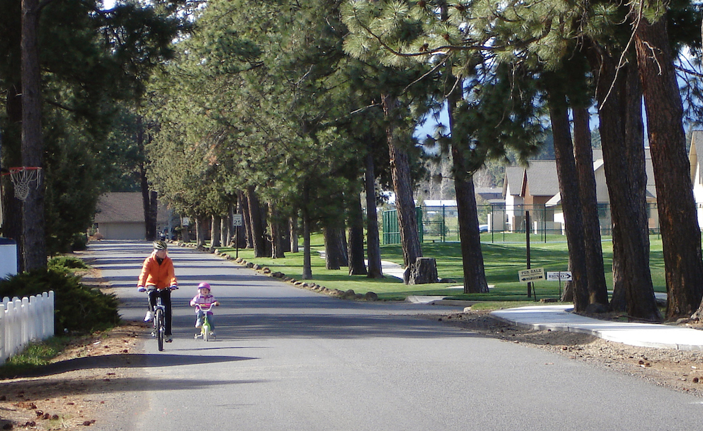
A yield roadway is designed to serve pedestrians, bicyclists, and motor vehicle traffic in the same slow-speed travel area. Yield roadways serve bidirectional motor vehicle traffic without lane markings in the roadway travel area.
Case
Study

Photo Gallery
Benefits
-
Less costly to build and/or maintain than fully paved cross sections.
-
Limits impermeable surface area and minimizes stormwater runoff.
-
Encourages slow travel speed when narrower than 20 ft (6.0 m).
-
Supports on-street or shoulder parking for property access.
-
Connects local residential areas to destinations on the network.
-
Maintains aesthetic of narrow roads and uncurbed road edges.
-
Can support a larger tree canopy when located within wide unpaved roadside areas.
-
Low maintenance needs over time.
Introduction
Yield roadways can effectively serve local travel needs, maintain aesthetic preferences, and is a common form for low-volume local rural roads. When operating at very-low volumes and at low speeds, pedestrians and bicyclists are comfortable walking within the travel area of the roadway.
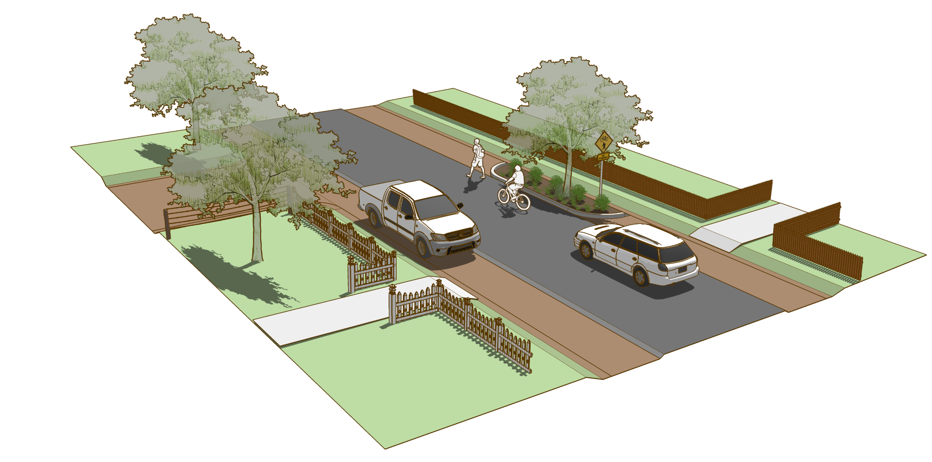
Yield roadways are designed with narrow roadway dimensions to prioritize local access and community livability.
For more information on related roadway types, refer to sections on Slow Streets and Shared Streets in FHWA Achieving Multimodal Networks 2016.
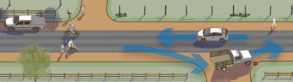
Figure 2-1. When vehicles travelling in opposite directions meet, the two vehicles may not have enough room to pass within the travel area. One vehicle may need to pull into a parking lane, pull-out, or driveway area to let the other pass.
Geometric Design
The paved two-way travel lane should be narrow to encourage slow travel speeds and require courtesy yielding when vehicles traveling in opposite directions meet.
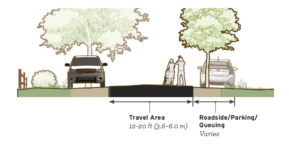
- Total traveled way width may vary from 12 ft (3.6 m)–20 ft (6.0 m).
- Traveled way width below 15 ft (4.5 m) or below function as a two-way singlelane roadway and should follow the guidance of the AASHTO Low Volume Roads 2001.
- When width is 15 ft (4.5 m) or narrower, provide pull-out areas every 200–300 ft to allow for infrequent meeting and passing events between motor vehicles. Pull-out areas may be established in the parking lane or roadside area.
- Access for emergency vehicles should be provided. There is no single fire code standard for local roads; however, a range of clear widths for parking and deploying fire department apparatus is between 16–20 ft (5.0–6.0 m). Designers should provide an opening of this width every 200–300 ft (600–91 m).
Figure 2-2. A travel area width of 16–18 ft (4.8–5.5 m) is appropriate for low volumes of twoway traffic and may require slowing when vehicles traveling in opposite directions meet. A travel area of 12–15 ft (3.6–4.5 m) is too narrow for two motor vehicles to pass, and one vehicle may need to pull into a parking lane, pull-out, or driveway area to let the other proceed.
If desired, parking may be located on the paved roadway surface or on gravel or soil shoulders outside of the paved roadway. The parking lane may also serve as a pull-out area while yielding.
- When possible, the parking lane should be constructed with a contrasting material to differentiate the lane from the travel area. Bituminous, crushed stone, gravel, and turf shoulders can be used as contrasting materials to the travel area (AASHTO Green Book 2011, p. 4-13).
- Trees may be planted within the roadside area at regular intervals to visually and physically narrow the corridor, add to the aesthetic environment, and encourage slow speeds.
Markings
No markings are necessary to implement a yield roadway.
- Do not mark a center line within the travel area. The single two-way lane introduces helpful traffic friction and ambiguity, contributing to a slowspeed operating environment.
Signs
Use signs to warn road users of the special characteristics of the street. Potential signs include:
W11-2
W6-3

Figure 2-3. Pair a W11-1, W1-2, or W11-15 warning sign with a custom legend plaque to inform road users that shared use by pedestrians and/or bicyclists might occur.
Intersections
At uncontrolled crossings of local streets, no special treatment is necessary. The additional space within the intersection area offers queuing opportunities when vehicles traveling in opposite directions meet.
- Consider parking prohibitions of 20–50 ft (6.0–15.0 m) in advance of intersections. This is particularly helpful to accommodate large vehicle turning movements.
- Provide adequate stopping sight distance around curves and at uncontrolled intersections. Values of stopping sight distance for two-way single-lane roads should be twice the stopping sight distance for a comparable two-lane road.
Implementation
In rural communities with a disconnected street network, local streets are the only viable connection to a scene of an emergency. Implementing agencies should work closely with emergency response stakeholders.
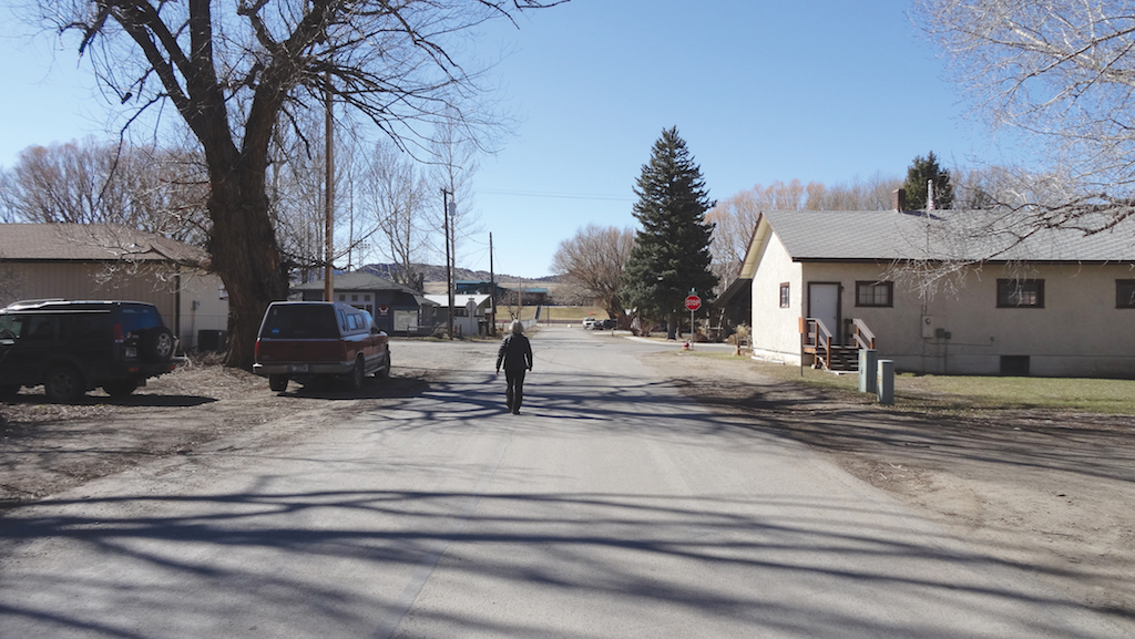
Sisters, OR – Population 2,170
Western Transportation Institute
Accessibility
Yield roadways allow motor vehicles, bicyclists, and pedestrians to share the same space. On very low-volume and low-speed streets, pedestrians and bicyclists may be comfortable using the roadway with the occasional vehicle. If this facility is intended for use by pedestrians, it must meet accessibility guidelines for walkways.
Ennis, MT – Population 850
Western Transportation Institute
Yield Roadway Case Study
Manzanita, Oregon
The residents of Manzanita cherish their small town and have outlined ways to maintain this character. One of the goals identified in the town’s Comprehensive Plan is “to maintain and create residential living areas which are safe and convenient, which make a positive contribution to the quality of life, and which are harmonious with the coastal environment.” Toward this end they have a network of local streets that create peaceful conditions for people walking, bicycling, and driving.
In addition, there is a recognition that even on collector streets bicycle and pedestrian travel should be safe. The plan states that “Sufficient pavement width should be included on all major streets or roads to accommodate bicycle traffic.”
Where a visually or physically separated facility is not provided, speeds will be slowed to create bicycle-friendly conditions. The plan states, “Efforts to reduce speeding on Laneda Avenue should be carried out by the city. This should take the form of maintaining a low speed (20 Mi/h), requesting that the City police and Tillamook County Sheriff’s Department maintain a high level of enforcement and installing appropriate warning signs.” Efforts such as these enable Manzanita’s local streets to be shared roadways where people driving, walking, and biking can all safely share the street.
Community Context
Manzanita is a quiet, peaceful village surrounded by the natural beauty of the Pacific Ocean, Neah-Kah-Nie Mountain, and State and private forests. The Manzanita area is home to 725 full time residents. In the summer the population swells to 2,500 to 3,000.
Key Design Elements
The standard City residential street is 20 ft wide paved with asphalt and with a concrete gutter along one side.
Role in the Network
Manzanita’s local streets connect residences with the ocean, parks, and downtown. The ability to use these shared local streets allow people walking or on bikes to access all parts of the community.
Funding
The key aspect of this treatment is that it requires funding beyond what is currently used to maintain the local streets. The City maintains the streets that have been brought up to city standards. Graveled streets that have not been brought up to City standards are maintained by the adjacent property owners. There are some roads within the City that are County roads maintained by Tillamook County.
For more information refer to the City of Manzanita website.
Selected Examples
Works Cited
American Association of State Highway and Transportation Officials. Guide for the Planning, Design, and Operation of Pedestrian Facilities. 2004.
American Association of State Highway and Transportation Officials. A Policy on Geometric Design of Highways and Streets. 2011.
American Association of State Highway and Transportation Officials. Guidelines for Geometric Design of Very Low-Volume Local Roads. 2001.
Burden, Dan, and Zykofsky, Paul. Emergency Response: Traffic Calming and Traditional Neighborhood Streets. 2000.
Federal Highway Administration. Achieving Multimodal Networks. 2016.
Federal Highway Administration. Manual on Uniform Traffic Control Devices. 2009.
Oregon Department of Transportation (ODOT). Neighborhood Street Design Guidelines: An Oregon Guide for Reducing Street Widths. 2000.