


Sidewalk
Sidewalks provide dedicated space intended for use by pedestrians that is safe, comfortable, and accessible to all. Sidewalks are physically separated from the roadway by a curb or unpaved buffer space.
Case
Study
Application
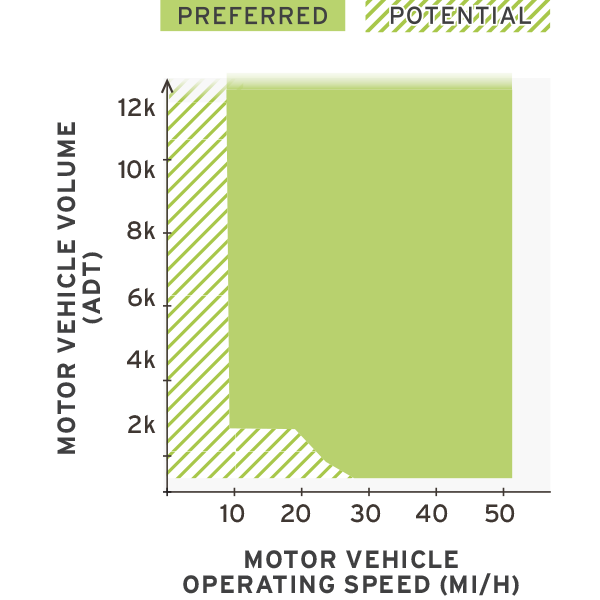

Photo Gallery
Benefits
-
Provides a dedicated place within the public right-of-way for pedestrians to safely travel and reduces pedestrian collisions in rural areas.
-
Reduces “walking along roadway” crashes.
Considerations
-
Sidewalks may not support a rural visual character when configured with curb and gutter and no landscaped separation.
-
Requires a moderate-width roadside environment to provide for separation and sidewalk area outside of the adjacent roadway.
Introduction
Sidewalks are desirable to support pedestrian safety and comfort in areas with a mix of land uses and also in areas of the community where the roadway network connections have generally high traffic volumes or speeds.
Denmark, SC – Population 3,400
Alta Planning + Design
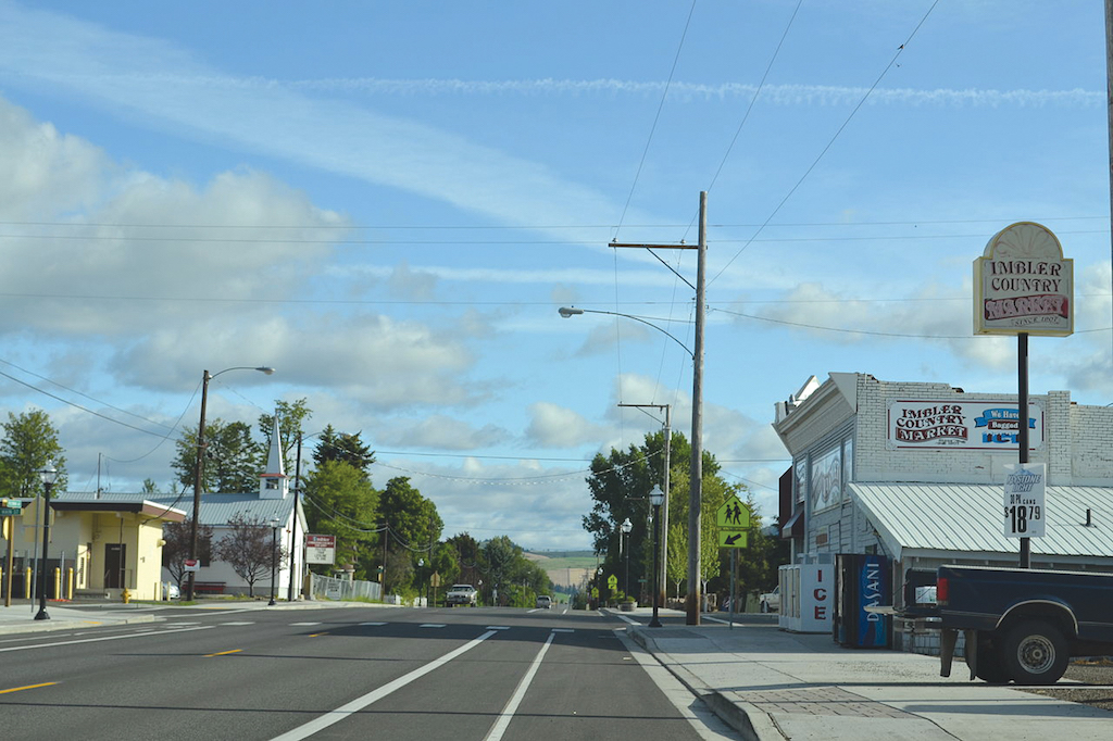
Figure 4-14. Sidewalks should be physically separated from the roadway by an unpaved buffer separation, barrier or curb edge.

Geometric Design
Sidewalks serve multiple important functions and should be designed with three distinct zones to accommodate these uses. Table 4-3 provides recommended and constrained minimum dimensions for a sidewalk elements.
FRONTAGE ZONEThe frontage zone is a shy zone adjacent to the property line and provides space for people to enter and exit buildings.
- Next to buildings with active ground floor uses, the frontage zone may be widened to 4–6 ft to provide room for door swing, café seating, product display, and window shopping.
- On most sidewalks, a frontage zone of 1–2 ft (0.3–0.6 m) allows for shy distance to fences and building walls. No frontage zone is necessary adjacent to parks or open space.
Table 4-3. Minimum recommended dimensions for sidewalks
The pedestrian through zone is the clear width needed for pedestrian travel activity and should be wide enough for two people to walk side-by-side.
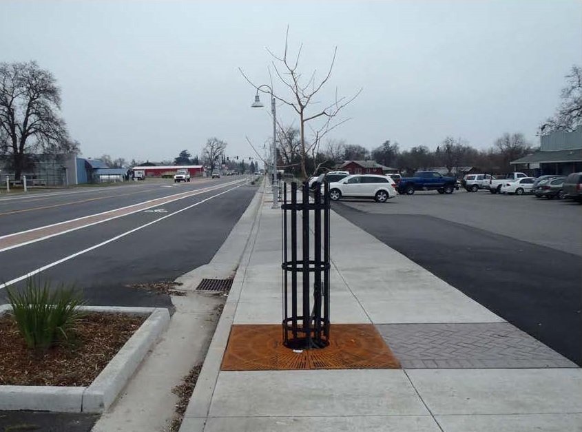
The furnishing zone is closest to the street and provides space for mailboxes, signs, street lighting, and other utilities. This area serves as snow storage areas in winter climates and protects pedestrians from splash during rain events.
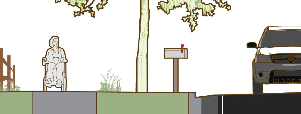
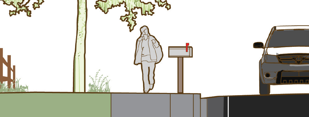
Figure 4-15. Sidewalks on roads with curbs may feature an unpaved or paved furnishing zone separation (left), or may be constructed with curb a gutter, immediately adjacent to the roadway (right). Offering separation from the roadway is preferred in most areas for user comfort and design flexibility at intersections.
Intersections
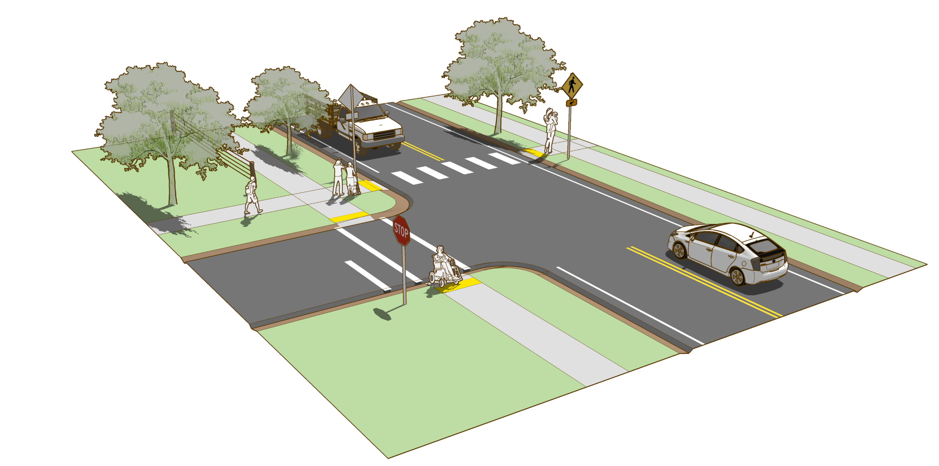
Legal crosswalks often exist at all intersections, whether marked or not. A crosswalk at an intersection is defined as the extension of the sidewalk across the intersection.
Unmarked CrosswalksLane markings, stop lines, yield lines, or other traffic control markings should be placed outside of the unmarked crosswalk area. The only way a crosswalk can exist at a midblock location is if it is marked.
Marked crosswalks are at intersections or midblock crossings based on engineering judgement. They are not to be used indiscriminately. For more information on evaluating locations for crosswalk markings, refer to FHWA Safety Effects of Marked Crosswalks at Uncontrolled Locations 2005.
- The minimum width for a marked crosswalk is 6 ft (1.8 m).
- For improved visibility, the preferred crosswalk marking pattern at uncontrolled and midblock locations is the high-visibility “continental” crosswalk marking. If placed to avoid the wheel track, these markings may last significantly longer than transverse line crosswalks.
- Use of transverse line crosswalk markings should be limited to signalized intersections, or crossings of side streets controlled by stop signs.
- Minor crossings of local streets may be unmarked.
Markings
No roadway markings are required on sidewalk installation. At intersections, stop lines, yield lines, and crosswalks may be used to clarify pedestrian crosswalk area.
Signs
No signs are required on sidewalk installation. Signs may be used to enhance the awareness of crosswalk locations, to remind drivers of the obligation to yield to crossing pedestrians, such as the R10-15 sign shown below.
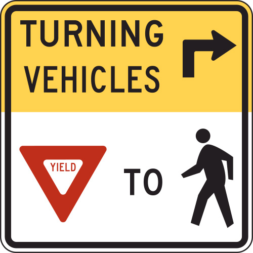
Figure 4-16. R10-15 sign for use at potential right turn conflict locations.
Implementation
Stormwater ManagementA furnishing zone is often configured as an open ditch for stormwater catchment and infiltration. Ditches can be retrofitted into bioswales or raingardens for filtration and water purification.
Construction MaterialsWhile sidewalks are commonly constructed with concrete, less expensive walkways constructed of asphalt, crushed stone, or other stabilized surfaces may be appropriate. Ensure accessibility and properly maintain all surfaces regularly.
Accessibility
A sidewalk is a separated facility intended for use by pedestrians and must meet accessibility guidelines for walkways and curb transitions. Sidewalks are required to be accessible by all users.
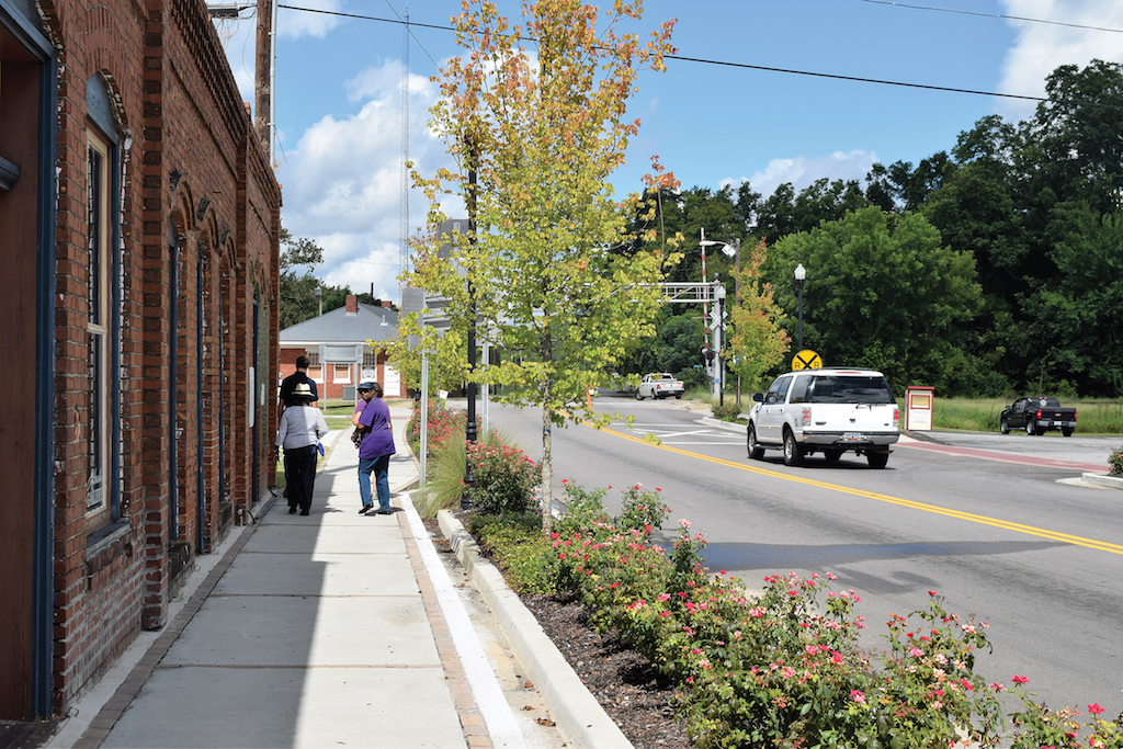
Altamont, NY – Population 1,609
Alta Planning + Design
Sidewalk Case Study
Miles City, Montana
The Miles City Active Living Taskforce is an involved group working to encourage residents of Miles City to be more physically active. It was the catalyst for starting a Safe Routes to School (SRTS) program in Miles City. With support from the Montana Department of Transportation’s SRTS program, a bicycle and pedestrian safety program was started at Garfield Elementary school. The program is taught by the health enhancement staff and the school resource officer.
The Garfield School sidewalk project was identified through SRTS effort in Miles City and included the installation of approximately 1/2 mile of sidewalk. The northeast portion of Miles City is an area of mostly low income residential development. While most streets in this part of town lack accommodation for bicycles and pedestrians, many children in the area walk or bike to Garfield Elementary. Garfield is the largest of four elementary schools in Miles City with 67 percent of students eligible for free or reduced lunch.
The sidewalks were installed along Lincoln Street, North Lake Avenue, and Riverside Street. This route functions as a collector for a number of neighborhood streets and is the connection to the school. In addition to providing a walking route to the school, the sidewalk project provides access from these neighborhoods to the park along the south side of Lincoln Street.
Community Context
Miles City is located at the confluence of the Tongue and Yellowstone rivers in southeastern Montana. It is the county seat for Custer County with a population of 8,400. Miles City is a medical and financial hub in eastern Montana with a strong agricultural economy.
Key Design Elements
Concrete sidewalk was installed behind a gravel shoulder that also serves as parking for the homes and park along Lincoln Street.
Role in the Network
The sidewalk installed under this project connects the low-speed, low-volume neighborhood streets to a network of existing sidewalks in the area around Garfield School. It provides a critical network link between home, school, and the park.
Funding
The project was funded with Federal SRTS funds, as well as Community Transportation Enhancement Program (CTEP) funds and local matching funds from Miles City. While constructed at the same time, funding for the project was applied for in phases and received funding in two different SRTS funding cycles.
For more information, refer to the City of Miles City.
Selected Examples
Works Cited
American Association of State Highway and Transportation Officials. Guide for the Planning, Design, and Operation of Pedestrian Facilities. 2004.
Federal Highway Administration. Crosswalk Marking Field Visibility Study. 2010.
Federal Highway Administration. Safety Effects of Marked Versus Unmarked Crosswalks at Uncontrolled Locations. 2005.
Institute of Transportation Engineers (ITE) Technical Committee 109-01. Pavement Marking Patterns Used at Uncontrolled Pedestrian Crossings. 2010.
United States Access Board. Proposed Guidelines for Pedestrian Facilities in the Public Right-of-Way (PROWAG). 2011.