


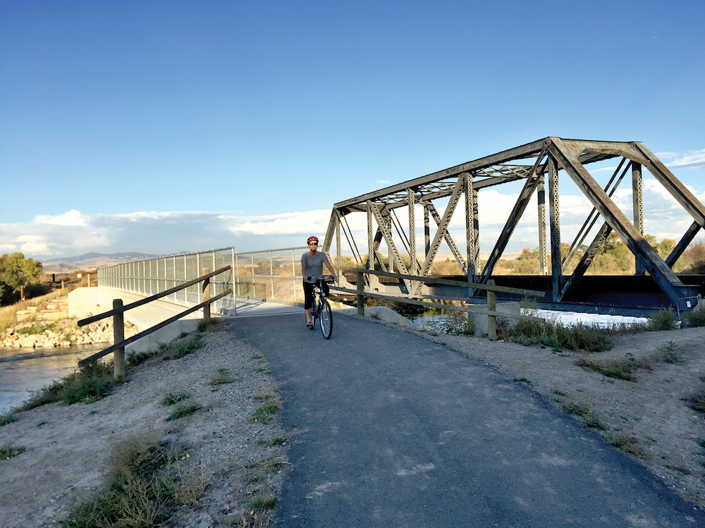
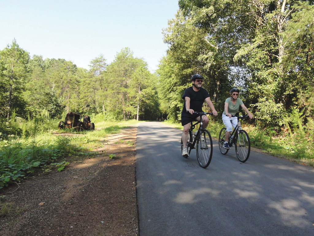
Shared Use Path
A shared use path provides a travel area separate from motorized traffic for bicyclists, pedestrians, skaters, wheelchair users, joggers, and other users. Shared use paths can provide a low-stress experience for a variety of users using the network for transportation or recreation.
Case
Study
Application


Photo Gallery
Benefits
-
Provides a dedicated facility for users of all ages and abilities.
-
Provides, in some cases, access to areas that are otherwise served only by limited-access roadways.
-
Provides nonmotorized transportation access to natural and recreational areas, which can especially help low-income people obtain access to recreation.
-
Provides, in some cases, a short-cut between cities or neighborhoods.
-
Supports tourism through convenient access to natural areas or as an enjoyable recreational opportunity itself.
-
Paths have a small footprint and can display a distinctly rural character.
Introduction
Shared use paths offer network connectivity opportunities beyond that of the roadway network. These facilities are often located in parks, along rivers, beaches, and in greenbelts or utility corridors where there are few conflicts with motorized vehicles. For paths adjacent to roadways, see Sidepath.

Yacolt, WA – Population 1,600
Alta Planning + Design
Geometric Design
WidthThe geometric design of shared use paths should support the speed and volume of expected user types.
- 10 ft (3.0 m) width is recommended in most situations and will be adequate for moderate to heavy use.
- A 2 ft (0.6 m) shoulder should be provided on each side of the path, kept clear of vertical elements or obstructions.
- 8 ft (2.4 m) is the minimum allowed for a two-way bicycle path and is only recommended for low traffic situations or for short lengths.
- 12-14 ft (3.6–4.3 m) is recommended for heavy use situations with high concentrations of multiple users.
- Wider paths are useful to accommodate maintenance vehicles; on steep grade to allow for comfortable passing and meeting; and through curves to provide more operating space.
Figure 4-1. Shared Use Path Dimensions
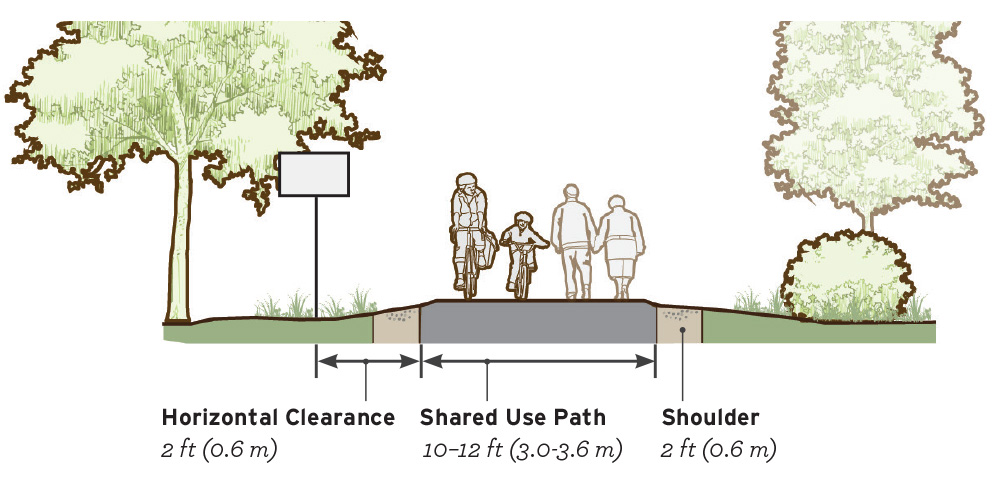
Table 4-1. Pathway Volume and User Mix

Springdale, AR – Population 75,000
Alta Planning + Design

Bentonville, AR – Population 40,000
Alta Planning + Design
Markings
StripingUnder most conditions, center line markings are not necessary, and path users will naturally keep right except to pass.
On shared use paths with heavy peak hour and/or seasonal volumes, the use of a center line stripe may help organize pathway traffic.
- When striping is required, use a 4 inch broken yellow center line stripe with 4 inch solid white edge lines.
- Solid center lines can be provided on tight or blind corners and on the approaches to roadway crossings.
- Mark edge lines on paths expecting evening use.
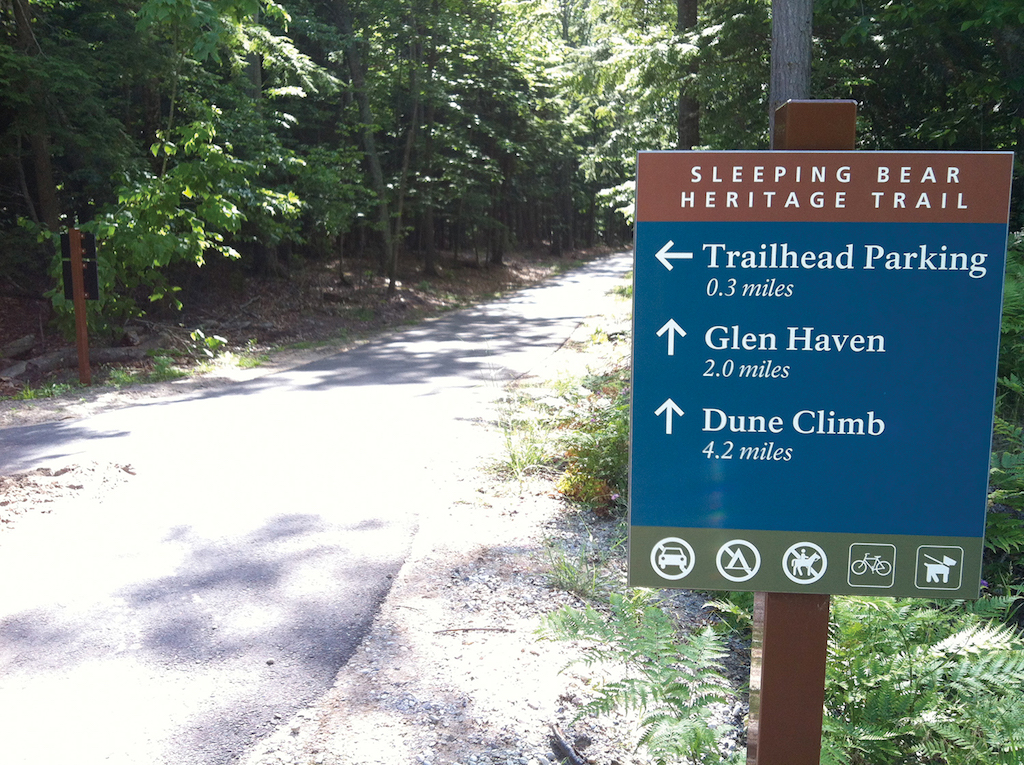
Signs
In a mixed user environment, Yield etiquette signs may be used. An example is shown in Figure 4-2. Many communities have created customized signage to reflect local user groups and conditions.
- Bikes Yield to Peds (R9-6) signs may be used at the entrances of path segments to remind bicyclists of the requirement to yield.

Figure 4-2. Signs can clarify yielding rules in shared-use environments may be modified based on expected user types.
Intersections
Motorists should yield right-of-way to pedestrians within crosswalks. Depending on State or local laws, motorists may also yield to bicyclists within crosswalks.
Figure 4-3 identifies recommendations related to marked crosswalk installation and enhancement by speed and volume on two-lane streets.
FHWA Safety Effects of Marked Crosswalks at Uncontrolled Locations 2005 recommends crossing enhancements on highspeed and high-volumes roadways where crosswalk markings alone are not a viable safety measure.
For additional information on marked crosswalks, refer to the Enhanced Crossing Treatments section of FHWA Achieving Multimodal Networks 2016 and BIKESAFE 2014.

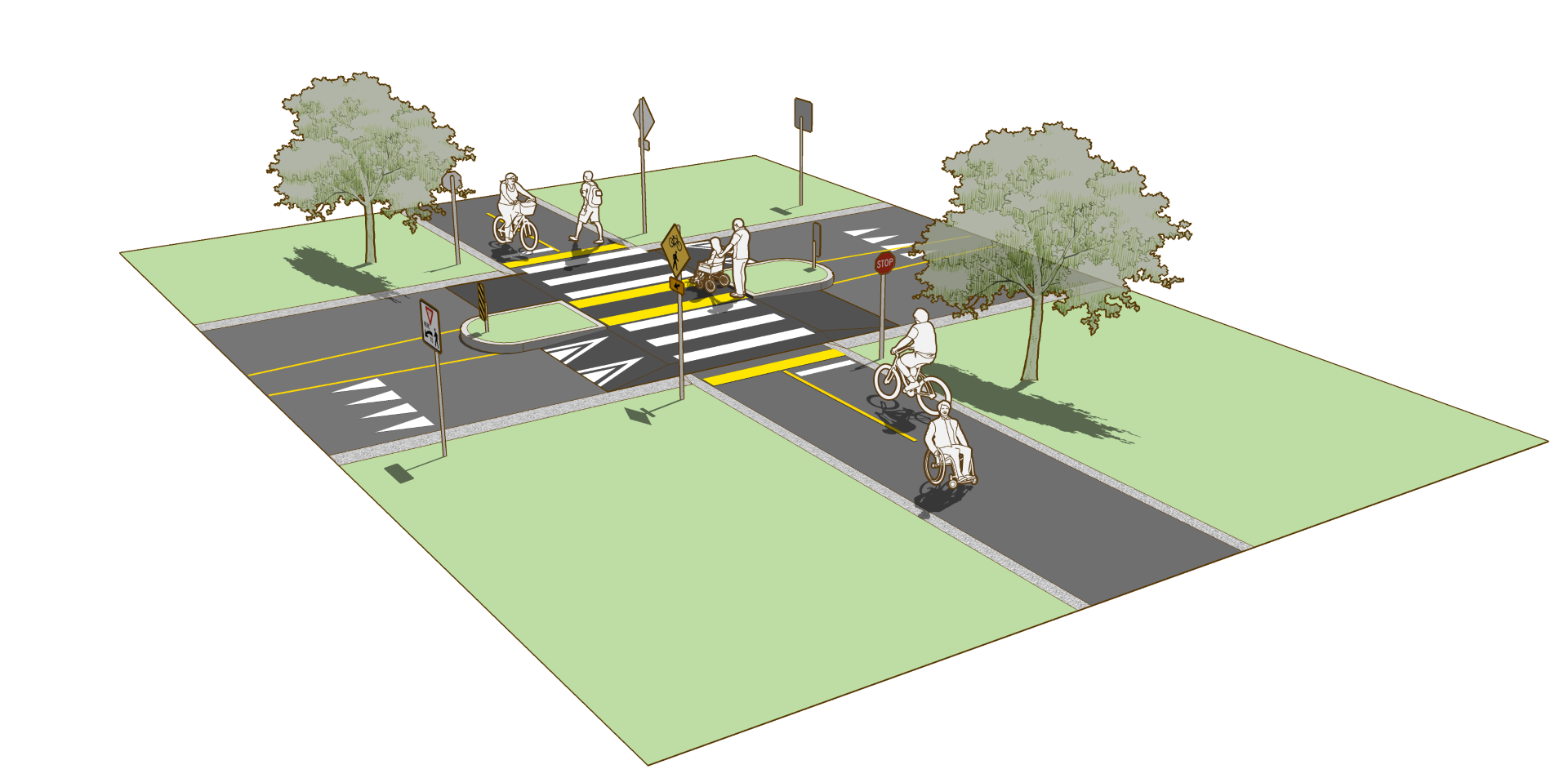
Figure 4-3. Conditions unsuitable for a marked crosswalk alone are candidates for additional enhancements such as curb extensions, median islands and/or active warning beacons. Chart adapted from FHWA Safety Effects of Marked Crosswalks at Uncontrolled Locations 2005 Table 2-11 (data for two-lane roadway at non school crossings).
A basic marked shared use path crossing consists of a marked crosswalk, plus signs and other markings to slow or stop traffic.
- Crosswalk markings establish a legal crosswalk at areas away from intersections.
- Crossing sign assemblies and advance crossing sign assemblies using W11-15 and W16-7P signs should be used to warn users of the crossing location.
High-visibility crosswalk markings are the preferred marking type at uncontrolled marked crossings. Transverse lines are “essentially not visible” when viewed from a standard approaching vehicle (ITE 2010).
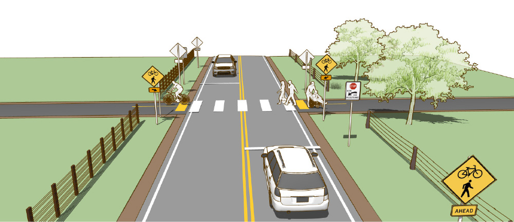
Figure 4-4. A simple marked crosswalk may be appropriate at crossings with low motor vehicle speeds and volumes.
Median islands are beneficial on roadways with high volumes and/or high speeds, and on roadways with three or more travel lanes. Median islands particularly benefit people who may travel slower, such as children, older adults, and people with disabilities.
Median islands are an FHWA Proven Safety Countermeasure.

Figure 4-5. A median safety island should allow path users to cross one lane of traffic at a time. The bicycle waiting area should be at least 8 ft deep to allow for a variety of bicycle types. To promote yielding to bicyclists the median safety island should be designed to require horizontal deflection of the motor vehicle travel lanes.
Where greater visibility or traffic control is desired, a rectangular rapid flash beacon (RRFB) or pedestrian hybrid beacon (PHB) may be used.
- RRFBs are a yield enhancement device for use at uncontrolled crossings. They may be configured with solar power where it is the most cost-effective option. See FHWA Interim Approval 11 2008 for guidance on the application of RRFBs.
- PHB’s provide a red signal indication to drivers, and create yielding rates similar to that of a conventional traffic signal. PHBs are particularly useful on undivided roadways with multiple lanes in any one direction. PHBs are an FHWA Proven Safety Countermeasure. See FHWA Pedestrian Hybrid Beacon Guide 2015 for more information.
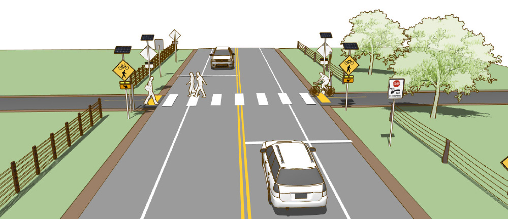
Figure 4-6. Where yield compliance is low, rectangular rapid flash beacons can be used to draw attention to crossing path users and signal their intent to cross.
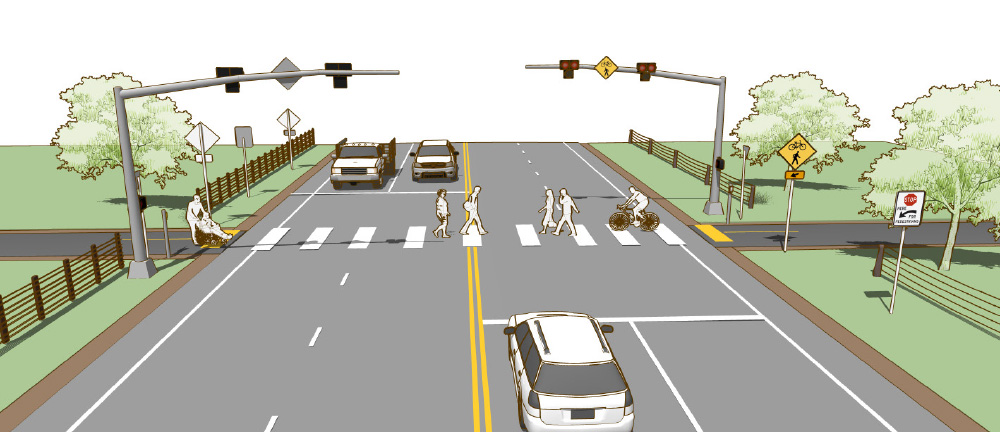
Figure 4-7. On multilane streets with high volumes and few gaps for crossing, a pedestrian hybrid beacon may be used to increase yielding rates.
Implementation
Asphalt is the most common surface for shared use paths. The use of concrete for paths has proven to be more durable and significantly reduces maintenance costs over the long term. Saw-cut concrete joints rather than troweled improve the experience for wheeled path users.
Accessibility
A shared use path is a separated facility intended for use by pedestrians and must meet accessibility guidelines for walkways and curb transitions. Shared use paths are required to be accessible by all users, including those with mobility devices and vision disabilities.
Shared Use Path Case Study
Pickens and Easley, South Carolina
The Pickens “Doodle Line” Railway is a 7.4-mile railroad that previously connected the cities of Pickens and Easley for lumber and other freight travel. As freight and manufacturing in Pickens declined in the late 1990s, the private owner of the railway decided to explore options to sell the ownership rights and promote a rail to trail conversion. The Doodle Trail, a 7.4 mile rails-to-trails partnership between the City of Easley and the City of Pickens opened Memorial Day Weekend 2015.
The shared-use asphalt path provides a vital recreation and transportation corridor for visitors and residents alike, as well as major economic and regional impacts. Residents and governmental leaders saw the economic impacts of the Swamp Rabbit Trail, an over 20-mile rail-trail in neighboring Greenville and wanted to create a similar regional attraction, that also benefited the local community.
The City of Easley and City of Pickens jointly purchased the railway corridor, creating a cooperative partnership between the two cities. Soon after the trail was completed in Spring 2015, residents of Easley saw the economic development potential of the shared use path and wanted it to extend to their businesses in downtown Easley, approximately 1 mile from the Doodle Trailhead. An extension of the path, from the trailhead to downtown, is currently in the design phase and construction is set to begin in Winter 2016.
Community Context
The City of Easley has a population of 20,300. The City of Pickens, located to the northwest, has a population of 3,150. Both cities are located within Pickens County.
Key Design Elements
Fencing, landscaping, and roadway crossings were all designed and constructed to ensure a safe, attractive path between the two communities.
Role in the Network
The shared use path serves as a transportation and recreation corridor for residents and visitors, and enhances connectivity between the two communities. The City of Pickens developed bike lanes to connect to downtown Pickens. The City of Easley is extending the trail into downtown and has provided bike lanes for alternate connections to Baptist Easley Hospital and cultural amenities.
Funding
Both cities used separate General Obligation Hospitality Tax Bonds to fund the acquisition and construction of the trail. The City of Easley is currently using a General Obligation Bond to fund acquisition, design, and construction of the shared use path extension into Downtown. The federally-funded Recreational Trails Program administered through the South Carolina Department of Parks, Recreation, and Tourism funded the extension to Highway 8.
For more information, refer to the City of Easley and the City of Pickens.
Selected Examples
Works Cited
Federal Highway Administration. Achieving Multimodal Networks. 2016.
Federal Highway Administration. Bicycle Safety Guide and Countermeasure Selection System. 2014.
Federal Highway Administration. Interim Approval for Optional Use of Rectangular Rapid Flashing Beacons (IA-11). 2008.
Federal Highway Administration. Manual on Uniform Traffic Control Devices (MUTCD). 2009.
Federal Highway Administration (FHWA). An Overview and Recommendations of High-Visibility Crosswalk Markings Styles. 2013.
Federal Highway Administration. Pedestrian Hybrid Beacon Guide. 2015.
Federal Highway Administration. Proven Safety Countermeasures. 2012.
Federal Highway Administration. Safety Effects of Marked Versus Unmarked Crosswalks at Uncontrolled Locations. 2005.
Federal Highway Administration. Shared-use Path Level of Service Calculator. 2006.
Institute of Transportation Engineers (ITE) Technical Committee 109-01. Pavement Marking Patterns Used at Uncontrolled Pedestrian Crossings. 2010.
Uniform Vehicle Code (UVC). 2000.
United States Access Board. Proposed Guidelines for Pedestrian Facilities in the Public Right-of-Way. 2011.